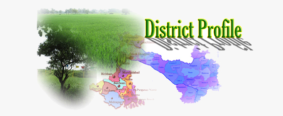
• HOME
  • AGROMET ADVISORY
  • APPs DEVELOPED BY KVK
    • Soil Test Based Fertilizer Recommondation
    • Fertilizer Calculator
    • KVK BURDWAN Apps
  • REPORTS
  • FARMERs DATABASE
    • Andal Block
    • Aushgram-I Block
    • Aushgram-II Block
    • Barabani Block
    • Bhatar Block
    • Burdwan-I & Burdwan-II Block
    • Faridpur-Durgapur Block
    • Galsi-I Block
    • Galsi-II Block
    • Jamalpur Block
    • Jamuria-I Block
    • Jamuria-II Block
    • Kalna-I Block
    • Kalna-II Block
    • Kanksa Block
    • Katwa-I Block
    • Katwa-II Block
    • Ketugram-I Block
    • Ketugram-II Block
    • Khandaghosh Block
    • Memari-I Block
    • Memari-II Block
    • Mongalkote Block
    • Monteshwar Block
    • Pandabeswar Block
    • Purbasthali-I Block
    • Purbasthali-II Block
    • Raina-I Block
    • Raina-II Block
    • Raniganj Block
    • Salanpur Block
    • BURDWAN DISTRICT
  • USEFUL LINKs
    • I.C.A.R.
    • C.R.I.J.A.F.
    • ATARI Kolkata
    • KVK Portal
    • India Meteorological Department
    • BURDWAN DISTRICT
    • mKisan Portal
  • Burdwan District Profile
  • Evolution of the KVK
  • Host Institute
  • Methodology of working
  • Front Line Demonstration
  • On Farm Testing
  • Training Programmes
    • Agronomy
    • Horticulture
    • Veterinary
    • Fishery
    • Plant Protection
    • Home Science
    • Agril. Extension
  • Other Extension Activities
  • Women in Agriculture
  • Collaborative Programmes
  • Impact & Success Stories
  • The KVK Family
  • KVK Photo Gallery
  • Reach Us

Origin:

The name Burdwan is the anglicized form of Barddhaman. There are two schools of thoughts about the name Barddhaman. It might have been named after the 24th Jaina Tirthankar. According to Kalpasutra of the Jains, Mahavira spent sometime in Astikagram which was formerly known as Barddhaman. According to the second school, Barddhaman means prosperous growth centre. In the progress of Aryanisation from Upper Ganges valley, the frontier colony was called Barddhaman as a landmark of growth and prosperity. The name came to stay as the Aryans failed to consolidate their gains further east.

Geography:

The district extends from 22°56' to 23°53' N latitude and from 86°48' to 88°25' E longitudes. Lying within Burdwan Division, the district is bounded on the north by Dumka (of Jharkhand), Birbhum and Murshidabad, on the east by Nadia, on the south by Hooghly, Bankura and Purulia and on the west by Dhanbad (of Jharkhand) districts.

The river Barakar forms the State boundary to the west; the Ajay separetes Birbhum and Dumka to the north with exception of a portion of Katwa subdivision; the Damodar forms a southern boundary with Purulia and Bankura, while Bhagirathi forms the main eastern boundary with a few exceptions. The maximum length from east to west is 208 Km while the maximum breadth from north to south is 112 KM. In shape the district resembles a hammer.

The district with it’s varied tectonic and riverine features is a transitional zone between Chotanagpur Plateau and the Gangetic alluvium. As per classification made under NARP, West Bengal has been classified under six zones. District Burdwan having diversified features, falls under three zones, namely old alluvial zone, new alluvial zone and red and laterite soil zone. The KVK farm at Bud Bud, however, falls under old alluvial zone.

Agriculture:

Burdwan is the only district in the state of West Bengal that is fortunate both in industry and agriculture. On an average about 58 percent of the total population belongs to the agricultural population while the non-agricultural sector accounts for the remaining 42 percent.

The eastern, northern, southern and central areas of the district are extensively cultivated but the soils of the western portion being extreme lateritic type are unfit for cultivation except in the narrow valleys and depressions having rich soil. Rice is the most important crop of the district. Paddy covers maximum of the gross cropped area. Among commercial crops, jute, sugarcane, potato and oilseeds are major crops. Productivity of the major crops grown in the district is indicated below. Major cropping patterns include paddy-wheat-vegetables, paddy – potato – sesame, paddy – vegetable – mustard and jute – paddy – vegetables.

Burdwan District at a Glance

Total Geographical Area: 7024 sq. km.
Head Quarter: Burdwan

Geographical Position
North Latitude Between 23° 53' N and 22°56'N
East Longitude Between 88°25'E and 86°48'E
Demographic Details
Sl. No Particulars Value
1
Population
 
Male
3588376
 
Female
3307138
 
Total Population
6895514
 
Rural
2547048
 
Urban
4348466
2
Population density / Sq. km
985
3
Literates
 
Male (%)
78.6
 
Female (%)
61.0
 
Total (%)
70.2
4
Details on SC/ST population
 
 
Male
1176724
 
Female
1125862
 
Total Population
2302586
5
Labour Profile
 
 
Total workers
2451241
 
Male workers
1920944
 
Female workers
530297
 
Rural Workers
1686683
 
Urban Workers
764558
 
Cultivators
361687
 
Agricultural Labourers
734022
 
Household Industry
121271
 
Other Workers
1234261
 
Marginal Workers
548907
 
Non-workers
4444273
6
Average labour wages for farm operations (Rs./manday of seven to nine hours)
Skilled job     Unskilled job
 
Peak Seasons
104.00                     96.00
 
Male
104.00                     96.00
 
Female
104.00                     96.00
 
Lean Seasons
104.00                     96.00
 
Male
104.00                     96.00
 
Female
104.00                     96.00
7
Major languages spoken in the district
Bengali, Hindi, Santhali
8
Details on Birth-Death Rate (per 1000 population)
 
 
Birth Rate
16.4
 
Death Rate
4.2
 
Infant Mortality Rate
1.94
 
Expectation of life in years
65
 
Male
67
 
Female
64

Sources: District Statistical Handbook, 2007. Bureau of Applied Economics and Statistics, Govt. of WB. and Dist. Information Office Burdwan

Taluk details
Name of the Taluk Total area (ha) Taluk HQ
Asansol
83189
Asansol
Durgapur
102865
Durgapur
Burdwan(N)
170106
Burdwan(N)
Burdwan(S)
141003
Burdwan(S)
Katwa
107048
Katwa
Kalna
99375
Kalna
Block details:(Administrative Blocks:31 nos., Agricultural Blocks:33 nos)
Sl. No. Name of the Block Total area in ha No. of Panchayat No. of Villages (2001)
01 Salanpur 13505 11 67
02 Barabani 15635 08 49
03 Raniganj 5828 06 12
04 Jamuria 15810 10 40
05 Galsi-I 25737 09 86
06 Andal 8487 08 13
07 Faridpur-Durgapur 15597 06 51
08 Pandabeswar 9780 06 17
09 Kanksa 27944 07 81
10 Burdwan-I 25041 09 78
11 Burdwan-II 18957 09 84
12 Aushgram-I 22234 07 58
13 Aushgram-II 36045 07 101
14 Bhatar 41501 14 104
15 Galsi-II 21909 09 73
16 Memari-I 18691 10 112
17 Memari-II 18684 09 88
18 Jamalpur 26302 13 121
19 Raina-I 26607 08 111
20 Raina-II 22728 08 87
21 Khandaghosh 26523 10 107
22 Mongalkote 36544 15 129
23 Ketugram-I 19398 08 62
24 Ketugram-II 16003 07 55
25 Katwa-I 16894 09 63
26 Katwa-II 16320 07 61
27 Purbasthali-I 14844 07 93
28 Purbasthali-II 19247 10 87
29 Kalna-I 16908 09 99
30 Kalna-II 17217 08 113
31 Monteshwar 30519 13 136

Name of the Block Total Population inclusive of SC / ST population SC / ST population
  Male Female Total Male Female Total
Salanpur 82767 73553 156320 24499 22977 47476
Barabani 57773 52620 110393 24454 23404 47858
Raniganj 55067 46559 101626 22316 20445 42761
Jamuria 59865 53028 112893 21924 20167 42091
Galsi-I 90531 83592 174123 33741 32235 65976
Andal 91593 77260 168653 24515 22118 46633
Faridpur-Durgapur 56203 49329 105532 20319 18645 38964
Pandabeswar 80009 66532 146541 26361 23584 49945
Kanksa 78574 72702 151276 35299 33620 68919
Burdwan-I 92650 87178 179828 33983 32961 66944
Burdwan-II 70837 68060 138897 34756 34413 69169
Aushgram-I 54675 52175 106850 25103 24130 49233
Aushgram-II 69948 66315 136263 35575 34196 69771
Bhatar 120943 115535 236478 48786 47448 96234
Galsi-II 68906 65071 133977 30232 29304 59536
Memari-I 100652 97626 198278 49693 49232 98925
Memari-II 69571 66100 135671 29327 28723 58050
Jamalpur 123524 119873 243397 60474 60478 120952
Raina-I 83611 79312 162923 31755 30934 62689
Raina-II 70819 66518 137337 29958 28756 58714
Khandaghosh 87636 82695 170331 34608 33321 67929
Mongalkote 120535 113423 233958 39995 38259 78254
Ketugram-I 74339 71520 145859 20208 19385 39593
Ketugram-II 55255 51799 107054 19313 18217 37530
Katwa-I 78669 73432 152101 25689 24373 50062
Katwa-II 61718 58600 120318 18169 17528 35697
Purbasthali-I 94571 88495 183066 26572 25005 51577
Purbasthali-II 96969 91092 188061 28509 26775 55284
Kalna-I 97839 92902 190741 38124 37470 75594
Kalna-II 78464 75216 153680 41269 40459 81728
Monteshwar 110163 103335 213498 27682 26743 54425

(Source: Dist. Statistical Handbook, Burdwan, Bureau of Applied Economics & Statistics, Govt. of W.B. 2007 and Dist. Information Office Burdwan)

Block-wise literacy rate (%)
Name of the Block Other than of SC / ST population SC / ST population
  Male Female Total Male Female Total
Salanpur 90.2 75.9 83.6 84.0 60.5 72.6
Barabani 80.4 60.0 70.9 71.5 39.8 56.0
Raniganj 81.2 60.3 71.9 72.0 45.7 59.4
Jamuria 85.1 60.8 73.8 73.0 47.0 60.5
Galsi-I 81.4 62.6 72.5 68.5 48.6 58.8
Andal 89.4 74.6 82.9 72.4 48.2 60.9
Faridpur-Durgapur 83.2 65.3 74.9 72.5 44.9 59.3
Pandabeswar 84.7 62.3 74.7 62.4 41.0 52.3
Kanksa 88.2 68.4 78.8 68.2 45.6 57.2
Burdwan-I 86.4 70.6 78.8 69.0 48.2 58.8
Burdwan-II 86.5 67.8 77.5 69.0 48.2 58.7
Aushgram-I 79.4 61.4 70.6 64.4 44.6 54.7
Aushgram-II 80.5 60.2 70.7 65.1 43.2 54.4
Bhatar 81.0 65.0 73.2 65 44.8 55.0
Galsi-II 79.6 66.4 73.3 69.2 41.6 55.6
Memari-I 84.2 70.2 77.4 67.0 43.8 55.5
Memari-II 88.3 68.5 78.8 70.7 51.1 61.0
Jamalpur 84.5 65.9 75.5 64.5 46.7 55.6
Raina-I 87.8 75.6 81.9 78.1 56.2 67.3
Raina-II 89.6 70.2 80.3 78.8 61.0 70.1
Khandaghosh 88.3 72.9 80.9 74.6 54.3 64.6
Mongalkote 74.5 61.3 68.1 61.0 39.5 50.5
Ketugram-I 76.4 62.5 69.6 59.2 41.1 50.3
Ketugram-II 78.4 63.7 71.3 59.0 42.1 50.8
Katwa-I 75.6 61.9 69.0 63.9 43.5 54.0
Katwa-II 73.1 60.3 66.9 61.6 41.3 51.6
Purbasthali-I 83.6 68.5 76.3 71.8 52.9 62.6
Purbasthali-II 80.1 66.8 73.7 64.6 45.4 55.3
Kalna-I 82.0 69.3 75.9 68.3 45.1 56.8
Kalna-II 85.2 65.3 75.6 67.5 49.9 58.8
Monteshwar 81.9 64.4 73.5 65.5 50.8 58.3

(Source: Dist. Statistical Handbook, Burdwan, Bureau of Applied Economics & Statistics, Govt. of W.B. 2007 and Dist. Information Office Burdwan)

Educational and other infrastructural facilities of year (2008-09)
Sl. No. Particluars Numbers/Values
01 Educational facilities
a) Pre-primary 8312
b) Primary 4070
c) Middle 64
d) High 488
e) Higher Secondary 300
02 Professional colleges
a) Medical 3
b) Engineering 10
c) Agriculture 0
d) Veterinary / Fisheries 0
e) Others (Please specify)
03 Number of Arts and Science Colleges 27
04 Institutional Credit Facility
a) Name of the Lead Bank UCO Bank
b) Number of branches of lead bank in the district 72
c) Other Commercial Banks 417
d) Primary Land Development Bank 2
e) District Central Co-operative Banks 1
f) Urban Banks 52
g) Primary Agricultural Co-operative Credit Society 617
h) Housing Co-operative Societies 10
i) Employees Co-operative Societies 355
j) Weavers Co-operative Society 60
k) Industrial Co-operative Society 12
l) Khadi and Village Industries Societies 25
m) Industrial Co-operative Societies 16
n) Primary Co-operative Stores 35
05 Agricultural Marketing and Processing
a) Number of Regulated Markets 45
b) Number of Co-operative Marketing Society 2766
c) Number of Permanent Markets / Central Markets 40
d) Number of weekly markets / shandies 1200
e) Number of drying yards 1575
f) Number of storage godowns 310
g) Number of cold storage units for agricultural produce 104
h) Number of agro based / agri-based processing industries 1361
i) Small scale 941
ii) Medium scale 420
iii) Large scale --

(Source: Dist. Statistical Handbook, Burdwan, Bureau of Applied Economics & Statistics, Govt. of W.B. 2007 and Dist. Information Office Burdwan)

Agro-climatic features

a) Rainfall pattern during 2009-10

Sl. No. Month Rainfall in m.m.
Actual Normal % deviation
01 January 16.2 9 44
02 February 8.8 24 -173
03 March 25.8 28 -9
04 April 72.9 48 34
05 May 84.0 109 -30
06 June 23.8 229 -862
07 July 280.0 289 -3
08 August 234.2 280 -20
09 September 201.2 221 -10
10 October 156.3 83 47
11 November 7.9 15 -90
12 December 5.0 13 -160

b) Temperature prevailed during 2009-10

Sl. No. Month Mean Maximum ° C Mean Minimum ° C
Actual Normal % deviation Actual Normal % deviation
01 January 25.2 30 -16 6.9 9 -23
02 February 28.6 38 -25 10.7 14 -24
03 March 32.2 38 -15 12.9 16 -19
04 April 30.8 38 -19 17.1 21 -19
05 May 34.2 38 -10 18.2 22 -17
06 June 33.2 38 -13 17.3 21 -18
07 July 28.4 35 -19 19.3 24 -20
08 August 34.0 35 -3 24.0 24 0
09 September 34.0 34 0 23.0 23 0
10 October 33.4 34 -2 20.6 20 3
11 November 31.0 33 -6 16.7 14 19
12 December 31.0 30 3 11.2 11 2

c) Relative humidity during 2009-10

Sl. No. Month Mean Maximum %
Actual Normal % deviation
01 January 76 68 12
02 February 78 73 7
03 March 81 78 4
04 April 88 83 6
05 May 87 85 2
06 June 85 83 2
07 July 89 92 -3
08 August 91 94 -3
09 September 88 90 -2
10 October 86 89 -3
11 November 85 85 0
12 December 79 76 4

Source: Dist. Statistical Handbook, Burdwan, Bureau of Applied Economics & Statistics, Govt. of W.B. 2007 and Metrological observatory of CSRSJAF & KVK Burdwan and Principal Agricultural Office, Burdwan.

Land details

a) Nine fold classification of land and other land details during 2008-09

Sl. No. Particulars Area in ha % to the Total geographical area
01 Total geographical area 702400 --
02 Area under Forest 22270 3.17
03 Barren and uncultivable land 790 0.11
04 Land put into non-agricultural uses 195950 27.90
05 Cultivable waste 8060 1.15
06 Permanent pastures and other grazing lands 380 0.05
07 Miscellaneous tree crops and grooves not included in the net area sown 1200 0.17
08 Current Fallow 7700 1.10
09 Other Fallow 4610 0.66
10 Net Area Sown 457800 65.18
11 Area sown more than once -- --
12 Gross Cropped Area 897288 127

b) Details on operational holdings 2008-09

Sl. No. Classification category Category area* Operational area in ha % to total operational area Number of holdings % to total number of holdings
01 Marginal < 1 ha 191610 40.59 325565 71.89
02 Small 1 - 2 ha 149896 31.75 88410 19.52
03 Small-medium 2 - 5 ha 92627 19.62 32015 7.07
04 Medium 5 - 10 ha 36993 7.84 6817 1.51
05 Large > 10ha 992 0.21 60 0.01
  Total   472118   452867  

*Category area varies between states (Source: Dist. Statistical Handbook, Burdwan, Bureau of Applied Economics & Statistics, Govt. of W.B. 2007 and Principal Agricultural Office, Burdwan).

Irrigation Resources
Sl. No. Particluars Number Other related particulars Values
01 Canals      
  Government 292681 ha    
  Private --    
02 Tanks (ponds)      
  < 40 ha 5000 ha    
  =>40 ha    
03 Wells      
  Bore wells 1000 nos.    
  Dug cum bore wells    
  Deep Tube wells 185 nos.    

(Source: Dist. Statistical Handbook, Burdwan, Bureau of Applied Economics & Statistics, Govt. of W.B. 2007 and Agri-Irrgation Department, Purta Bhawan, Burdwan)

Soil resources and type
Sl. No. Name of the Block Soil type Major nutrients which are deficient Micro-nutrients which are deficient
01 Salanpur Lateritic P,K,S Zn, B
02 Asansol Lateritic P,K,S Zn, B
03 Hirapur Lateritic P,K,S Zn, B
04 Barabani Lateritic P,K,S Zn, B
05 Raniganj Lateritic P,K,S Zn, B
06 Jamuria-I Lateritic P,K,S Zn, B
07 Jamuria-II Lateritic P,K,S Zn, B
08 Kulti Lateritic P,K,S Zn, B
09 Galsi-I Clay -- Zn, B
10 Andal Lateritic P,K,S Zn, B,Mo
11 Faridpur-Durgapur Lateritic P,K,S Zn, B,Mo
12 Kanksa Sandy Loam P Zn, B,Mo
13 Burdwan Clay Loam P,K Zn, B
14 Aushgram-I Clay Loam -- Zn, B
15 Aushgram-II Sandy Loam -- Zn, B
16 Bhatar Clay Loam, Sandy -- Zn, B
17 Galsi-II Clay -- Zn, B
18 Memari-I Loam -- Zn, B
19 Memari-II Sandy Loam S Zn, B
20 Jamalpur Clay -- Zn, B
21 Raina-I Loam -- Zn, B
22 Raina-II Clay Loam -- Zn, B
23 Khandaghosh Loam -- Zn, B
24 Mongalkote Clay Loam K,S Zn, B
25 Ketugram-I Clay Loam -- Zn, B
26 Ketugram-II Clay Loam -- Zn, B
27 Katwa-I Clay Loam P,S Zn, B
28 Katwa-II Clay Loam -- Zn, B
29 Purbasthali-I Gangetic Bindhya Alluvial -- Zn, B
30 Purbasthali-II Gangetic Bindhya Alluvial -- Zn, B
31 Kalna-I Loam -- Zn, B
32 Kalna-II Gangetic Alluvial -- Zn, B
33 Monteshwar Clay Loam K Zn, B

(Source: Annual Plan 2009-2010 on Agriculture for Burdwan district, Principal Agricultural Office, Burdwan)

Area(ha), production(ton) and productivity(kg/ha) of major crops for 2008-09
Sl. No. Crop Net area sown(ha) Area sown more than once (ha) Total Cropped Area (ha) Cropping Intensity (%) 2008-09 Production (M.T.) Produ-ctivity (kg/ha)
01 Paddy (Aus) 30292 225000 43275 191 183183 4233
02 Paddy(Aman) 319470 402371 1792211 2735
03 Paddy (Boro) 150793 183895 711851 4305
04 Wheat 7794 -- 12991 27086 2084
05 Gram 1738 -- 2484 22807 918
06 Lentil 3701 -- 5694 5083 892
07 Mustard 34280 -- 50413 41731 827
08 Potato 50631 -- 67508 481602 7266
09 Jute 6848 -- 9131 131622 14414

(Source: Annual Plan 2009-2010 on Agriculture for Burdwan district, Principal Agricultural Office, Burdwan)

Area under irrigation for major crops for 2008-09

Table - I: (General Crops)

Sl. No. Crop Total Cropped Area (ha) Irrigated Area (ha) % of Irrigation
01 Paddy (Aus) 43275 5025 11
02 Paddy(Aman) 402371 342015 85
03 Paddy (Boro) 183895 183895 100
04 Wheat 12991 12991 100
05 Gram 2484 1242 50
06 Lentil 5694 2847 50
07 Mustard 50413 40330 80
08 Potato 67508 67508 100
09 Jute 9131 4565 50

Table - II: (Hybrid/ HYV Crops)

Sl. No. Crop Total Cropped Area (ha) Area under HYV / hybrids (ha) % of Irrigation
01 Aman Paddy (HYV) 402371 374326 93
02 Aman Paddy (Hybrid) 402371 15000 04
03 Boro Paddy (HYV) 183895 165675 90
04 Boro Paddy (Hybrid) 183895 30000 16
05 Maize (Hybrid) 1490 1000 68
06 Wheat (HYV) 12991 11561 89
07 Gram (HYV) 2484 1887 76
08 Lentil (HYV) 5694 3985 70
09 Mustard (HYV) 50413 41338 82
10 Potato (HYV) 67508 63457 94
11 Jute (HYV) 9131 8217 90

Table - III: (Other Hybrid/ HYV Crops)

Sl. No. Crop Total Cropped Area (ha) Area under HYV / hybrids (ha) % of Irrigation
01 Cereals
a) Paddy – Fine 740.00 1150.00 --
b) Rice – Fine 1057.00 1910.00 20.00
02 Pulses
a) Musur – Big      
b) Gram      
03 Oilseeds
a) Mustard      
04 Vegetables
a) Potato      
b) Brinjal      
c) Cabbage      
d) Cauliflower      
e) Tomato      
05 Fruits
a) Coconut      
b) Banana      
c) Mosambi      
06 Commercial including sugar and fibre crops
a) Sugar      
07 Spices and Plantation crops
a) Onion      
b) Dry Chilies      
c) Garlic      
d) Ginger      

(Source: Principal Agricultural Office, Burdwan)

Follow us at: new sectionnew section


2023 KVK Burdwan. All Rights Reserved|Developed by: Sk Golam Rasul